Case Study
Milburn Tip – Wigan
In April 2019 Flythru were engaged by geospatial surveying partners Geoterra to perform a highly accurate inspection survey an area of land owned by Wigan Council which had previously been subject to ground fires and was displaying obvious signs that part of this old mining tip was infact still on fire beneath the ground.
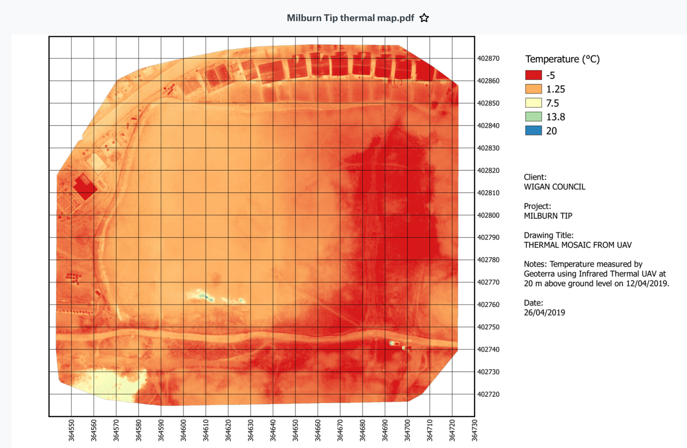
Flythru using the latest drone technology carrying specialist thermal sensors and PPK RGB imagery were engaged to provide the client with the exact location, extents and thermal properties of any heat sources they found. The survey was conducted early morning at first light after a cold clear night in order to identify the thermal anomalies at their most extreme.
An aerial survey involving PPK HD RGB imagery was undertaken though somewhat blocked by the prevalent vegetation to create a photographic orthomosaic which would assist in locating the thermal anomalies and providing 2d and 3d models when overlaying the thermal mosaic.
In addition to HD RGB images and thermal video a thermal othormosaic was created showing the obvious “hot spots’ their thermal properties and extents.
The imagery below shows the thermal map.

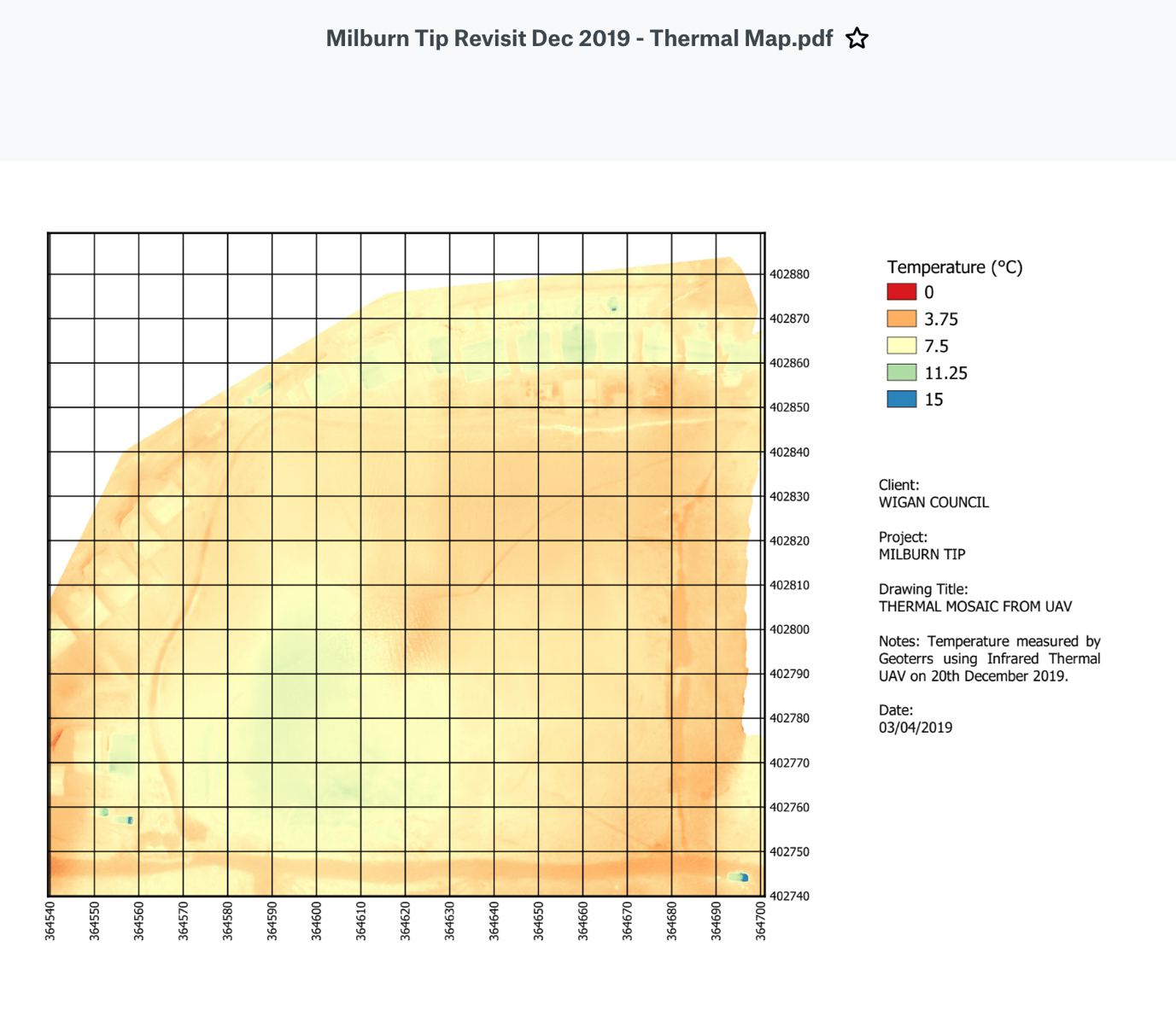
These UAV surveys enabled the client to map out a strategy to deal with the land and decide whether or not to clear the deposition site or monitor. The decision was made to monitor and re survey in December. FlyThru’s experienced team collected data using the same technologies and methods, the resulting thermal and RGB orthomosaics (Below)
showed that the temperature of the site had significantly reduced and the extents of the underground fire diminished again providing invaluable information for the client to carry on securing and monitoring the site and that there was no need for expensive clearance.

It should be noted and is clearly apparent that that the ground temperature differentials on the second survey were not as beneficial to the survey as on the 1st though the previous ‘hot spots’ had clearly diminished. This cost-effective survey provided the client with a full report showing ground imagery, video, thermal and aerial RGB photographs.
We cover the whole of the UK including London, Birmingham, Leeds, Glasgow, Sheffield, Bradford, Edinburgh, Liverpool, Manchester, Bristol, Wake field, Cardiff, Coventry, Nottingham, Leicester, Sunderland, Belfast, Newcastle upon Tyne, Brighton, Hull, Plymouth, Stoke-on-Trent, Wolverhampton, Derby, Swansea, Southampton, Salford, Aberdeen, Westminster, Portsmouth, York, Chester, Cambridge, Salisbury, Exeter and Bangor.